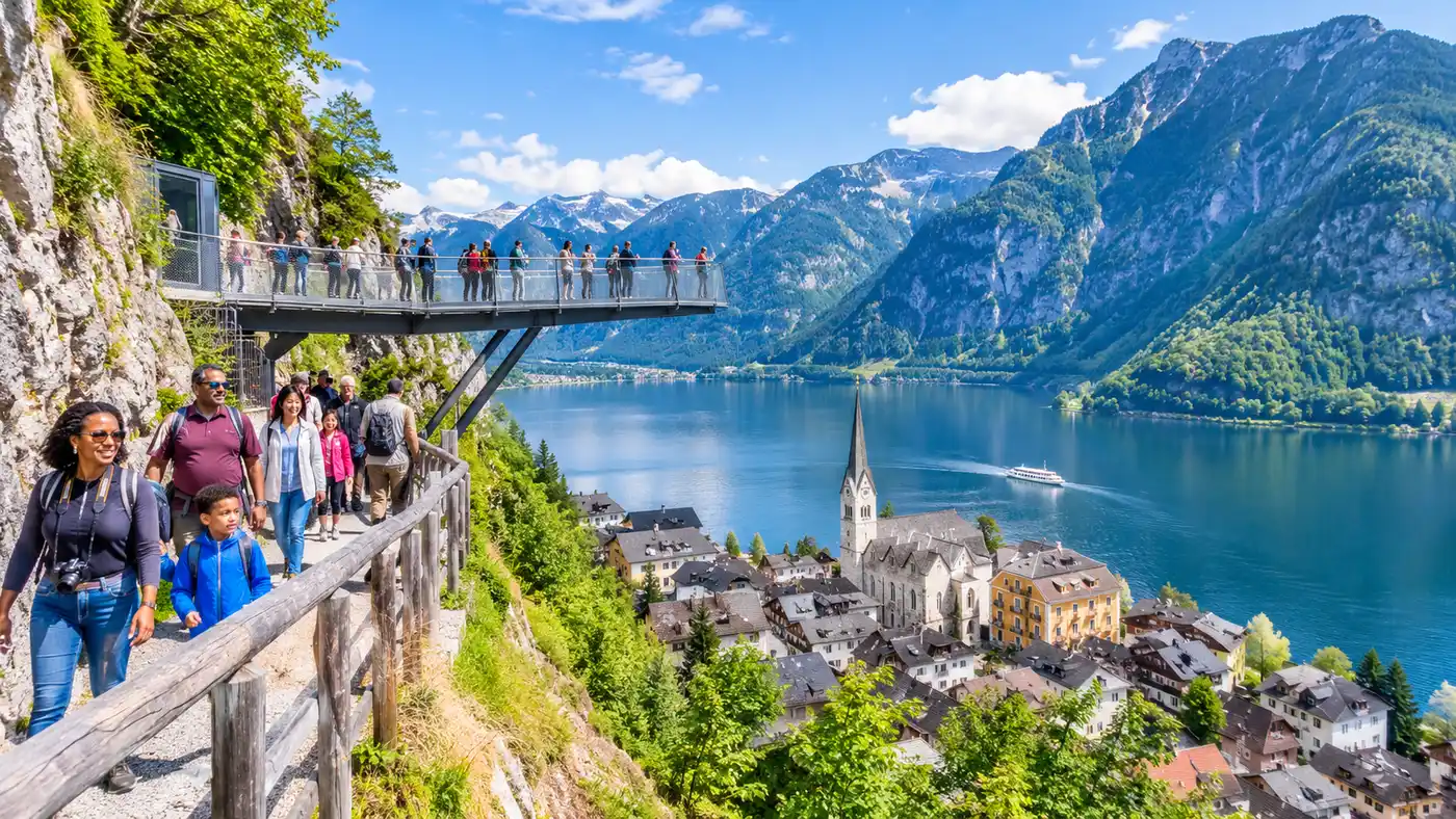
Hiking to Hallstatt Skywalk: Trail Route, Map & Tips
Most tourists visiting Hallstatt squeeze onto the funicular, waiting in long lines just to be dragged up the Salzberg in under three minutes. They miss the best part of the mountain. Choosing the hallstatt skywalk hike instead lets you leave the tour buses behind at the shoreline, earning the sweeping panorama of the lake one switchback at a time. The woods here smell damp and rich of pine, and you get quiet vantage points that railway passengers never see through their scratched glass windows.
The trail climbs directly up the steep eastern flank of the Plassen mountain range. It is direct, relentlessly steep, and surprisingly rewarding if you have decent shoes and an hour of spare energy. Whether you want to save money on train tickets, squeeze in some exercise before lunch, or just fancy tackling the skywalk hallstatt hike on your own two feet, this route will get you there without any guesswork.
Book your hallstatt skywalk experience:
Finding the Trailhead: Starting Your Hike Up to Hallstatt Skywalk
Getting lost before you even begin is easier than you think. Hallstatt is packed into a razor-thin strip of land between sheer rock and dark water, so trailheads do not announce themselves with massive gates or glossy signs. To start your hike up to hallstatt skywalk, you have two basic starting points in town.
The most straightforward approach starts right behind the Salzbergbahn valley station. Walk toward the funicular ticket office, skip the ticket booths, and head up the paved pedestrian ramp to the right. Within thirty steps, a yellow Austrian Alpine Club sign points uphill into the woods. If you are staying on the historic northern side near the market square, you can also start behind the Catholic parish church and cemetery. That path climbs up past old wooden houses on stone staircases before merging into the main route. I prefer starting by the church because walking past those centuries-old basements gives you a real feel for how locals climbed these hills before engines existed.
The trail itself is officially labeled as Trail 640 on regional hiking maps. In local German guides, you will see it listed as Wanderweg Skywalk Hallstatt or simply the path to the Rudolfsturm. The terrain underfoot changes quickly. You leave the village asphalt behind and step straight onto packed gravel, limestone chunks, and heavy timber steps pegged into the mountainside.
| Route Option | Duration | Elevation Gain | Difficulty | Cost |
|---|---|---|---|---|
| Standard Trail (Path 640) | 45 - 60 min | 352 m | Moderate | Free |
| Soleweg Pipeline Alternate | 70 - 85 min | 360 m | Easy-Moderate | Free |
| Salzbergbahn Funicular | 3 min | 352 m | None | Pay per ride |
Locals call this climb the Hallstatt Skywalk Wanderung. It is short on paper, measuring barely 2.1 kilometers from the road to the viewpoint. Do not let that compact distance fool you. The path rises roughly 350 vertical meters in that short span, which works out to an average gradient well above 16 percent. Your calves will notice the incline within five minutes.
The Ascent: Navigating the Hallstatt Skywalk Trail Step by Step
The bottom third of the Hallstatt Skywalk trail winds through a dense canopy of beech and sycamore trees. Early in the morning, mist tends to pool beneath the branches, keeping temperatures cool even on baking July afternoons. You cross over the rushing Mühlbach stream, which tumbles straight out of the gorge above town. If it rained overnight, the water runs loud and milky gray, pounding against the concrete spillways.
Keep your rhythm steady here. The trail begins as a series of wide zigs and zags, held together by thick wooden retaining logs. There are wooden benches perched every three or four bends. They look rustic, but they are mostly positioned where the forest opens up slightly, giving you clear pockets of blue lake framed by green leaves. Many hikers rush this section because they want to reach the metal viewing bridge quickly. Honestly, sitting down on the fourth switchback to watch tiny ferry boats cross the water below is half the joy of making the walk to Hallstatt Skywalk.
Pro tip: About halfway up, right near the ruins of an old covered salt chute, a tiny dirt spur leads fifteen steps off the main path to an unmarked rock ledge. It offers an unobstructed photo angle back down on the village church tower without a single tourist head in your frame.
As you pass the midway mark, the tree cover thins out and gives way to spruce and exposed rock faces. The path narrows. You will encounter rough limestone steps worn slick by decades of hiking boots, so tread deliberately. During the Austrian summer holidays, you will hear a polyglot of languages drifting down from above as walkers tackle the Skywalk Hallstatt wandern route. Everyone pants a little; nobody moves fast.
Toward the top, the trail snakes directly beneath the cables of the funicular. You will hear the gentle hum of the steel wire long before the cars appear. When the two red cars pass each other on their mid-mountain bypass track, it makes a strange metallic clatter that echoes off the limestone cliffs. Wave to the passengers inside if you want; they will mostly stare back through the glass with a mix of pity and admiration while you wipe sweat from your eyebrows.
Footwear, Timing, and Prep for the Skywalk Hallstatt Hike
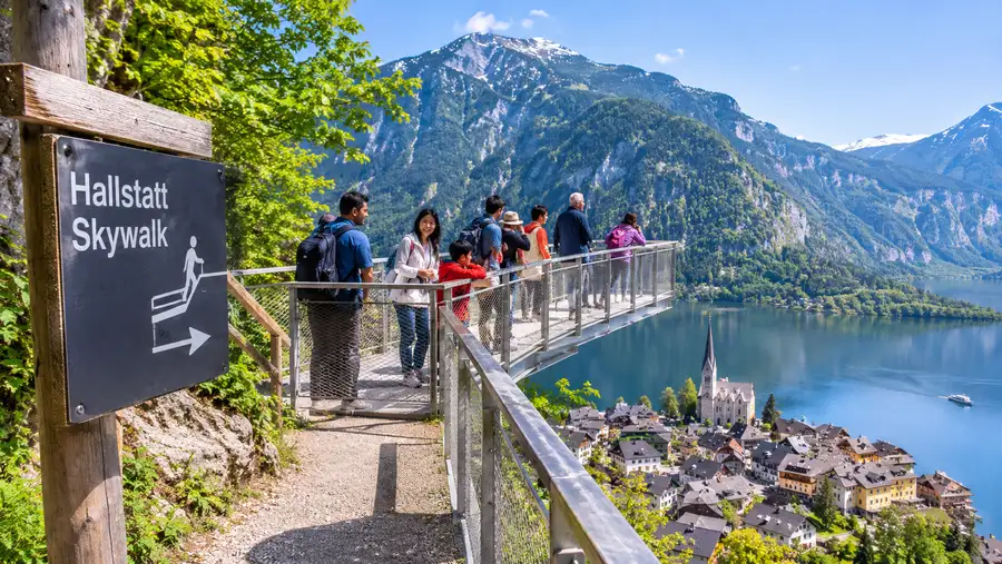
Can you do this climb in normal running shoes? Yes, absolutely. Can you do the Hallstatt Skywalk by foot in flimsy flip-flops or smooth leather dress sneakers? You can try, but you will regret it halfway down. The gravel is loose on the steeper turns, and after a midday alpine shower, the wet limestone turns as slippery as wet soap. Trail running shoes with deep rubber lugs are the sweet spot here.
Time your hike carefully. The worst time to climb is between 11:00 AM and 2:00 PM. During these peak hours, heat bounces fiercely off the western rock faces, and you will share the upper switchbacks with descended crowds trying to walk down. If you set out at 7:45 AM, you will have the entire mountainside to yourself. The lake lies completely flat like dark glass, the air tastes crisp, and you will arrive at the viewing platform right when the gates open, long before the first trainload of day-trippers drops off their groups.
- Water bottle: carry at least 0.75 liters per person, because there are no drinking fountains along the switchbacks until you reach the restaurant up top.
- Layered clothing: you will sweat heavily on the climb, but the lookout platform catches strong wind funnels coming off the Plassen peak.
- Trekking poles: completely optional on the way up, but remarkably helpful to save your knees on the descent.
- Cash coins: handy for the public restrooms located near the top platform, which charge a small entrance fee.
Note: In late autumn and early spring, shaded corners of this path hide thick patches of black ice even when the village down below feels mild. Check the trail condition boards at the valley station before starting out.
If you plan on pairing your climb with an underground tour, read our guide to the Hallstatt salt mine and Skywalk ahead of time. You will need roughly 90 minutes for the salt mine tour itself, so adding an hour of steep uphill hiking beforehand means you should pace your energy and leave plenty of time before your reserved entry slot.
Book your hallstatt skywalk experience:
Heading Down: Hallstatt Skywalk Cesta Dolů and Descent Options
Once you finish taking photos and exploring the mountain, you need to decide on your return journey. Czech and Polish visitors frequently search for the best Hallstatt Skywalk cesta dolů, which simply means the trail route back down the hill. You have three primary ways to descend from the viewpoint.
The simplest way down is retracing your steps along Trail 640. Going downhill takes roughly 30 to 35 minutes. It is fast, but it is steep enough to rattle your joints. If you have cranky knees, walking down can actually feel much tougher than climbing up. The constant braking on loose gravel forces your quadriceps to work overtime. Take small steps, lean slightly forward rather than leaning back onto your heels, and keep your hands out of your pockets for balance.
If you prefer an easier grade on the legs, take the Soleweg trail instead. This historic path branches off north of the Rudolfsturm and follows the path of the world's oldest active industrial pipeline, which carried brine down to Ebensee starting in the seventeenth century. The Soleweg winds along the mountain contours at a much gentler angle before dropping down toward the northern end of town near the Hallstatt Lahn bus station. It adds about 25 minutes of walking time, but the slope is far gentler on your joints and passes through quiet, mossy woodlands.
- Downhill by foot: saves cash, burns calories, but punishes tired knee joints on steep gravel.
- Downhill by funicular: quick 3-minute ride that lets your legs rest while you enjoy the glass-floor view.
- Soleweg detour: longer stroll with minimal slope that loops gracefully into the quiet edge of the village.
Your third option is buying a one-way downhill ticket for the funicular at the mountain station desk. It costs significantly less than a round-trip ticket. If you want to check the current rates for single rides down, take a quick look at the breakdown of Hallstatt Skywalk ticket prices before heading up. Hiking up and riding down is arguably the smartest compromise between physical effort and time efficiency.
Reaching the Skywalk: Rudolfsturm and the Viewing Platform
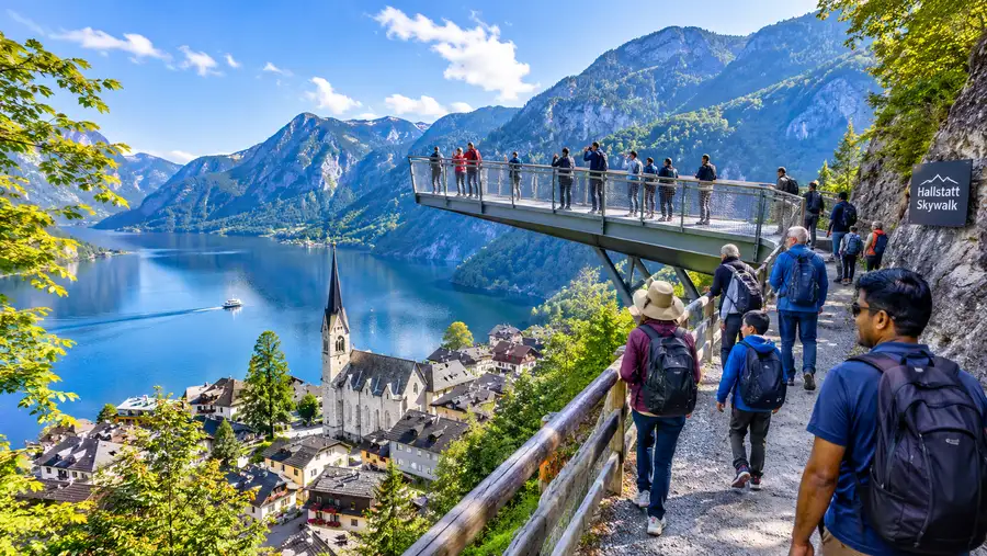
The final push of the climb leads up a series of broad wooden switchbacks supported by sturdy steel railings. You will pass underneath the old stone foundations of the Rudolfsturm. This defense tower was built back in the late thirteenth century by Duke Albrecht I of Austria to protect the lucrative salt operations from neighboring archbishops. Today, the ancient stone fortress operates as a restaurant with an expansive outdoor terrace.
Just past the restaurant terrace, the famous "World Heritage View" platform juts out dramatically into thin air. It is shaped like a sharp triangle, extending roughly twelve meters outward past the cliff face. Standing at the pointed tip puts you 350 meters straight above the rooftops of Hallstatt. The drop below the grated steel deck makes your stomach flutter, especially when a gust of wind whips up the valley from Obertraun.
From the tip, you can see the entire northern branch of the Hallstätter See curving between steep limestone slopes. The Dachstein massif looms in the background, often capped with bright snow well into June. It is completely free to walk out onto the platform once you reach the summit. You only pay money if you ride the funicular or go inside the salt chambers.
Grab a cold drink on the terrace of the Rudolfsturm if you can snag a table near the perimeter wall. The draft beer is cold, the elderflower spritzers are refreshing after an hour of uphill work, and sitting there feels ten times more satisfying knowing you earned every meter of that height on your own feet.
Frequently Asked Questions about hallstatt skywalk hike
How long does it take to hike to the Hallstatt Skywalk?
Most walkers in reasonable shape reach the viewing platform in 45 to 60 minutes. If you take frequent breaks to take photos or walk with young children, plan for around 75 minutes from the village center.
Is the skywalk hallstatt hike suitable for kids?
Yes, children aged seven and older generally handle the climb without issues if they are used to walking. The trail is wide and secure with safety railings in exposed spots, but it is much too steep and rough for strollers.
Can you hike the Hallstatt Skywalk trail in winter?
The trail is technically accessible year-round, but it is not formally cleared of snow or salted. Winter conditions bring hard-packed ice and avalanche warnings on the upper cliffs, so you need microspikes and warm boots between December and March.
Is there an entrance fee to use the trail?
No, the mountain hiking trail is completely free to use at all hours. You do not need any permits, passes, or timed entry tickets to walk up or stand on the Skywalk viewing platform.
Quick Reference
- Trailhead: behind Salzbergbahn or parish church
- Elevation gain: 352 meters
- Distance: 2.1 kilometers one way
- Average hiking time: 50 minutes
- Trail rating: moderate grade on gravel and timber steps
Book your hallstatt skywalk experience:
Before You Tie Your Laces
There is something distinct about smelling damp earth and listening to mountain birds while hundreds of people below wait in a crowded funicular queue. Hiking up to the Skywalk turns a hurried tourist selfie stop into an authentic alpine outing. Fill your water bottle at the town fountain, lace your shoes tightly, and take your time climbing out of the village. The view from that steel triangle tastes far sweeter when you sweat for it.
Read more about hallstatt skywalk.